
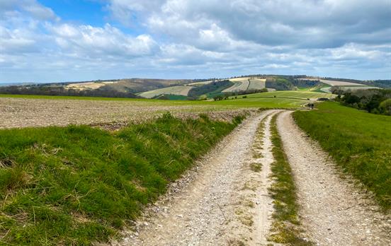
I am feeling nostalgic. A year ago a friend and I set out to walk the South Downs Way. For us a holiday is for challenge and discovery; we were not short of these along the Way. A brief account of our adventure follows. The drought of early 2012 came to an abrupt end in April. In fact it was the day we set off from Winchester. We had 100 miles of walking ahead of us. It was head down most of the first day, rain dripping from our noses, occasionally looking up to check directions. Even though the rain was torrential this boat was an unlikely sight, in the middle of nowhere, looking as though it had been left high and dry after a flood.

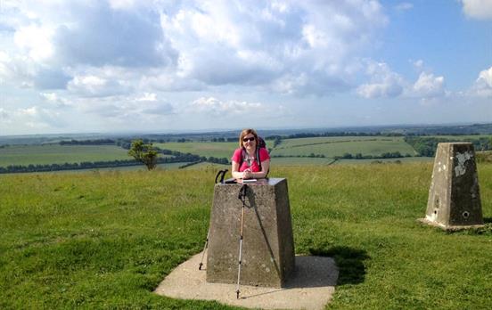
As we were passing Exton church an ‘all welcome’ sign prompted us to take advantage and eat lunch in the dry under the church porch. On our way again in the mud, it was one step forward and two back up to the Iron Age fort on Winchester Hill. There would have been a 360-degree panorama to be seen had it not been raining. After 19 wet miles, we waded through floods to reach our first overnight stop in East Meon. Our landlady welcomed us in and didn't seem to notice the trail of water we left through the hall. She toasted crumpets and made tea as we huddled to dry out around the Aga. Skies were dark and puddles were many and large on the second day, but we were optimistic about the day ahead. As we climbed up Butser Hill to the highest point (270m) on the Way we saw a brown hare. In Britain the hare’s rarity is second only to the water vole. The sun finally came out and we enjoyed an open-air lunch overlooking the village of South Harting with its green church spire.

Continuing up Beacon Hill we were lucky enough to hear a cuckoo. There has been a steep decline in numbers of migrant cuckoos in England according to a recent survey. We felt very privileged to hear it, in spite of it being a parasite! The grassy banks of the chalk track were lined with cowslips passing a huge ball of chalk just before the turnoff to Cocking, our overnight stay. 18 miles walked this day.

Chalk is a white soft limestone, which has been formed from the skeletons of marine creatures deposited, squeezed and eventually fossilised on the sea-bed. 20 million years ago the South Downs were raised from the seabed, through the movement of the earth’s crust. Flint formed from the skeletons of minute animals, can also be found amongst the chalk. Not long after setting out on day 3, it began to rain again. Spirits rose though as we glimpsed a deer ahead of us drinking from a puddle. It didn’t take long for it to spot us. Once up onto to Sutton Down the, the by now gale force wind blew hail painfully onto our faces. The heavens opened and we ran for cover. The Way continued over Bignor Hill, on part of the great Roman Stane Street that went from London to Chichester.

A short lunch break was taken on a damp log in Coombe Wood. We crossed the River Arun and climbed the steep Rackham Hill before Washington, our overnight stop, came into view down below. There was no-one at home. We had walked 18 miles, were cold and wet but there was a warm welcome at the Frankland Arms. More rain and wind on day 4. Over half of our walk was done. We climbed through woods back onto the Downs before passing the Chanctonbury Ring. This ring of beech trees was replanted after being flattened by the storm of October 1987. They had stood as a landmark, with tales of witchcraft, for over 200 years.

Eventually, the wind blew the rain away and the views emerging were stunning, especially from Truleigh and Fulking Hill looking towards Devil’s Dyke.

Dew ponds are a feature along this part of the way. Due to the chalk landscape, there is no drinkable surface water for grazing animals, so saucer-shaped scoops were dug out and lined with clay to store rainwater.

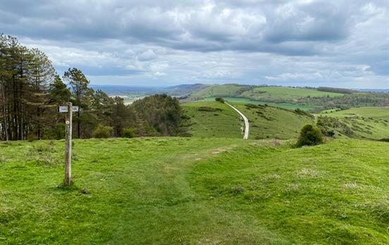
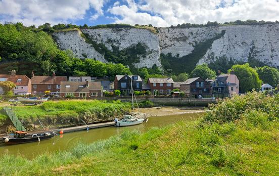
Our overnight stop in a 400-year-old cottage at Pyecombe was right on the Way. 13 miles walked today and our driest day so far. We left Pyecombe in the sunshine on day 5, passing Jack and Jill windmills back onto high easy walking towards Ditchling Beacon. The views again were stunning, the skylarks were singing. What could be better? We passed into the eastern hemisphere before the descent to Housedean.

A short climb took us onto Juggs Road; a one-time trading route used by fisherfolk from Brighton, who transported salted fish in earthenware jugs or pots. The Way took us through Southease village past the rare round Norman church tower and to our final climb of the day to the masts on Beddington Hill. Coastal towns and channel shipping were in view as we dipped down into Alfriston. Our longest day of 22 miles completed but rest was a while off as there was no-one at our B&B and no telephone signal. Fortunately, the Star Inn was serving tea. We chose the 11-mile coastal option to complete our walk but day 6 started cold, damp and windy and got worse as the day progressed. After a section along the River Cuckmere, a white horse carved on the slopes of High and Over came into view.

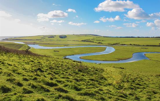
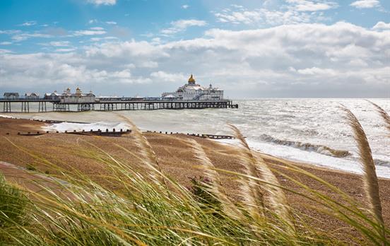
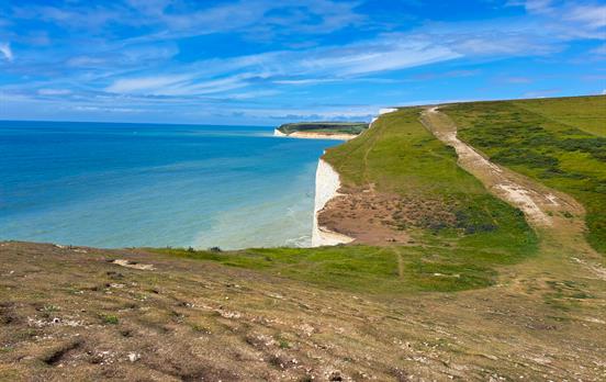
We passed Charleston Manor, the former home of Sir Oswald Birley (one of England's greatest undiscovered portrait painters) before climbing the 200 steps into Friston Forest. Views of Cuckmere Meanders and Haven, one of the only river mouths in the South-East not spoilt by development, were wonderful as we entered the Seven Sisters Country Park. To see the Seven Sisters chalk cliffs for the first time was slightly sad as this was the final stretch into Eastbourne and our adventure was nearly over.

Thankfully the gales blew us away from the cliffs at Beachy Head and we managed to find a sheltered spot under a gorse bush for lunch before the descent into Eastbourne. We were cold and wet but the landlord of our final B&B had a warm welcome for us.

We had walked 100 miles and loved it, rain and all. Thank you Macs Adventures for making it possible. If you are thinking of embarking on a long-distance walk, give the South Downs some consideration. Route finding is easy, it is, for the most part, on a ridge so, if the weather is clement, you will have unsurpassed views to the North Downs, the South Downs ahead, the villages below or to the sea. There are very few stiles and the walking is easy to moderate depending on the challenge you set yourself. Wildlife, flora, geology and history are abundant along the Way. Whatever you decide, reliable wet weather gear and waterproof boots are a must. This was the first time I had tested mine to the limit!
If you are interested in learning more about the walking the South Downs Way with Macs Adventure, have a look here.


 Australia
 New Zealand
 South Africa
 European Union